
Over the years I am convinced the best way to travel is on two wheels, and Cape Breton Island in Nova Scotia has always been high on my list to experience and explore by motorcycle.
Of Cape Breton, Alexander Graham Bell is quoted as saying,
''I travelled around the globe. I have seen the Canadian and American Rockies, the Andes and the Alps, and the Highlands of Scotland; but for simple beauty Cape Breton outrivals them all.''

To visit the Island is to travel on the magnificent Cabot Trail. Touted as among the most scenic roads in the world, it is 298 km (185 mi ) long, looping around the northern tip and named after explorer John Cabot who first arrived in 1497.


So it was that I set out for eight days in July 2011, joined by my good friend John to visit this glorious region of Canada and much of the Maritime provinces, as well as Québec's Gaspé Peninsula aboard our Honda Goldwings.

The first day would see John and I head out from home near Toronto and follow the St. Lawrence River, ending up by day's end in Montmagny, Québec.
Heading eastward on Hwy. 401 before sunrise, we make the obligatory stop at Tim Hortons, this one in Belleville after a couple hours on the road to chase the morning cobwebs froms our brains.


This would be one of many Timmies stops during the trip in which to add to my collection of Tim Hortons pix that I've visited by motorcyle over the years.
I know I drove John crazy with this !
"How much coffee can you drink?" he would ask.
 |
| Two hours later we arrive at the Québec border. |

We continue on, crossing to the southern shore of the St. Lawrence River before Montréal to pass through the suburbs of Valleyfield, Brossard, and St. Hubért where we soon stop for lunch.

Past the city of Trois-Riviéres we join Rte. 132 which hugs the river's edge around the Gaspé Peninsula, a thumb of land that extends into the Gulf of St. Lawrence.
Seeming to soar above the banks of the St. Lawrence R. in the village of Saint-Pierre-les-Becquets we spy Saint-Pierre-Apôtre Church.


This is one of many churches we would encounter, each a magnificent structure that dominates the village in which they are located, testifying to the influence the Roman Catholic Church had over the population for more than three centures. A number of them along the water's edge mark the spot where French settlers from the Old World first landed.
Its size and opulence makes one wonder how they are supported by their small congregations today.
Its size and opulence makes one wonder how they are supported by their small congregations today.
It was certainly a great resting spot for these weary travellers.
Past Québec City, we finally decide to stop in the town of Montmagny where we pitch our tents at Camping Pointe-aux-Oies, a delightful campground on the water's edge.
Fourteen hours and over 600 miles later, sleep is gonna be good.


Day 2 - Sun, July 24
Our second day will have us log 413 miles in 11.5 hours from Montmagny to the town of Gaspé, Québec.
View Larger Map

A very funky and well-dressed PT Cruiser at the local Timmies this morning during breakfast.


The many grand churches that dot the Gaspé landscape.


John and I take turns leading as the scenery on Rte. 132 becomes more rugged and the villages more isolated, and always the St. Lawrence River on the left.


Time for lunch in Rimouski which has a pretty promenade along the water's edge as you enter the town.

Y'know, despite the rap against McDonald's over the years, you can't beat it for speed and convenience for the hungry traveller on a budget.
In Sainte-Flavie, we come across the Centre d'Art Marcel Gagnon Restaurant
and Inn.


The inn was originally a cottage acquired by artist Marcel Gagnon in 1984 in which to exhibit his paintings and sculptures that sit on the beachfront, which eventually grew into its present form as an inn and tourist attraction.


The village of Baie-des-Sables


The village of Ste-Anne-Des-Monts.

Are we having fun yet?


Near Mont-St. Piérre

Day's end at Motel Adams in the town of Gaspé.
9.5 hours and 405 miles for this day from Gaspé to Shediac, New Brunswick.
View Larger Map

Another beautiful morning across the Baie de Gaspé

Several miles down Rte. 132 we glimpse our first view of Percé Rock in the distance

Approaching the town of Percé

Percé Rock, a huge rock formation with one of the world's largest natural arches and considered a natural icon of Quebec.
A half-mile offshore, it is mostly of limestone, 433 metres long, 90 metres wide and 88 metres at its highest point. The arch is 20 metres high.


Excursion boats take tourists around the Rock from the town's pier.

Percé, very touristy.


Another Timmies stop for lunch, this one in Paspébiac.

There's a few bucks invested in this gorgeous rig from Ontario carrying his motorcycle in the back of the trailer.

Everyone has their own means of travel.


Crossing the Mirimachi River.


There's a thought . . .


We arrive in Shediac where the edge of our campground meets the edge of town.

Twelve hours and 316 miles this day from Shediac, through Prince Edward Island, to Baddeck, Nova Scotia.
View Larger Map


Fortunately, this Timmies was within walking distance from our campsite to help us start the day.
The bike is loaded up and ready to go as the morning skies look ominous for the first time on the trip.

 Down the road we come across Lake's General Store in the tiny community of Murray Corner.
It is a third-gerneration store run by the lady in the pic, her father on her left.
If I remember correctly, the fellow in the white tee is the retired president of the Atlantic Canada division of the Loblaws stores empire.

Glimpsed from behind the store, our first look at Confederation Bridge which we will cross to Prince Edward Island.

PEI bound.


An engineering marvel, Confederation Bridge is the longest in the world crossing ice-covered water.
Opened to traffic in early 1997, it spans the Northumberland Strait for 13 km. (8 miles), built at a cost of a billion dollars. It provides Prince Edward Island with a fixed link to New Brunswick where access before was by air and ferry service.


Crossing the bridge into PEI.

A brief stop in Victoria-By-The-Sea, one of many communities I visited when I bicycled PEI in 1994.

Confederation House
Located in the provincial capital of Charlottetown, this is the site where the Dominion of Canada was founded in 1867 by the Fathers of Confederation, one of whom was John A. MacDonald who would become the fledgling country's first prime minister.


The ferry from Wood Island that will take us southward across the Northumberland Strait to Caribou Island, Nova Scotia, a crossing of 75 minutes. One of four ferries I will take on the trip.

Leaving PEI behind.

Local musician Allan Keough on the guitar provides the entertainment.
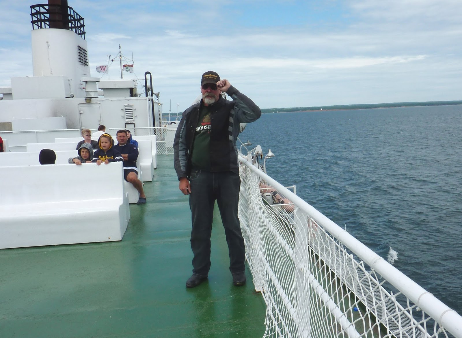

"Wake me when it's over"

We pass the sister ship going the other way.
Approaching Nova Scotia.

This way to Cape Breton.

This chap was one of many Newfoundlanders we met, all of whom are scattered throughout the Maritimes. He went on to regale us about the experimental hybrid
animals (?) throughout Cape Breton's countryside.
"Something like in Newfoundland?" I joked.
"Hell, no!" he laughed. "That's where men are men and the sheep are nervous!"
 The Canso Causeway, opened in 1955 connecting the island of Cape Breton to the Nova Scotia mainland.
At the far end is the Canso Canal Bridge that allows passage across the
Canso Canal.

The Canal allows continued access between between the Gulf of St. Lawrence and the Atlantic Ocean.


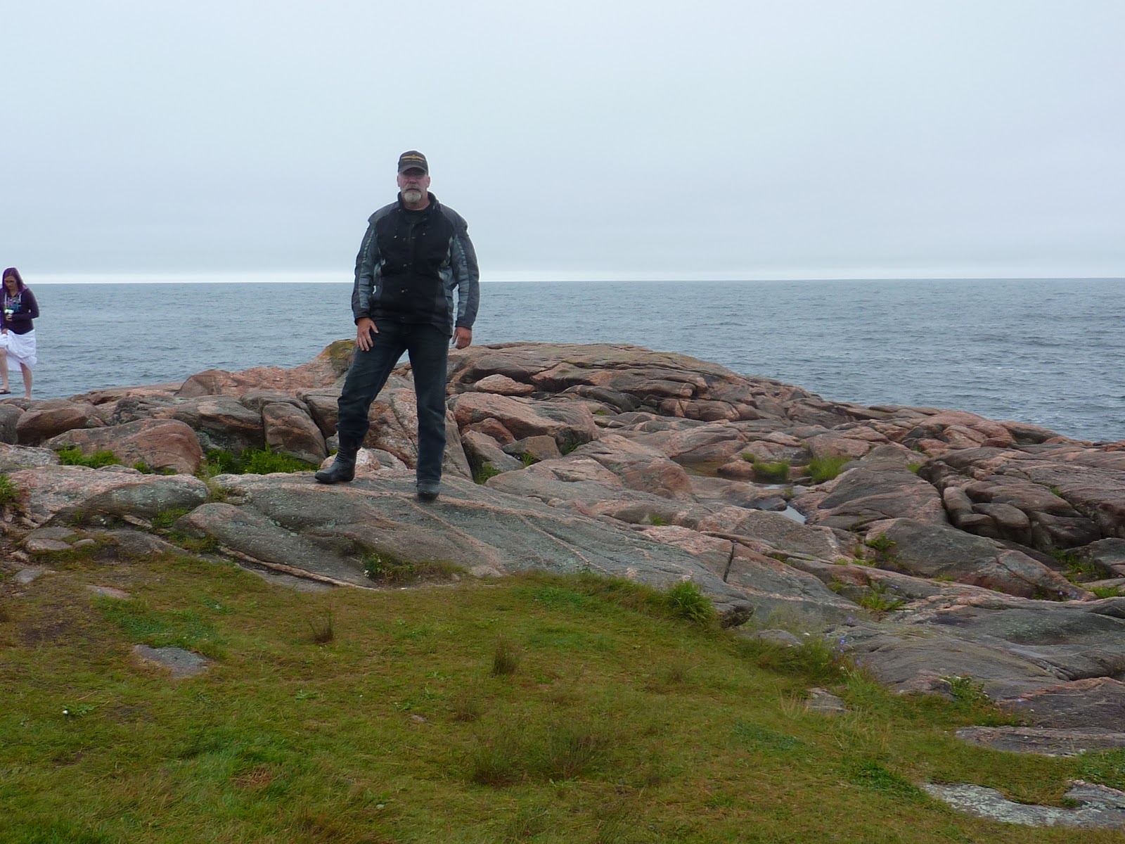
Pastoral scenery abounds in Cape Breton.

F**king GPS !!

John and I get ourselves back on course and finally make our way onto the Cabot Trail for the first time before setting up camp at Bras d'Or Lake Campground near Baddeck.


Eleven hours of travel and 247 miles today.
View Larger Map

Bright and early, John and I begin our loop around Cape Breton Island in a clockwise direction as recommended by the locals, contrary to the general idea of staying on the outside for the better view. I couldn't tell the difference. This pic is westward on Hwy. 19 as we make our way to the west side of the Island.

Margaree Harbour
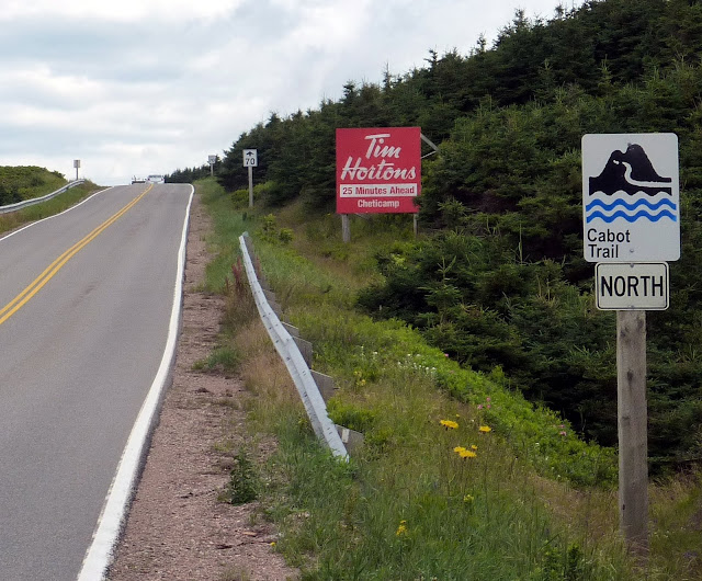
Even on the Cabot Trail !


Entering Cape Breton Highlands National Park


Simply beautiful !


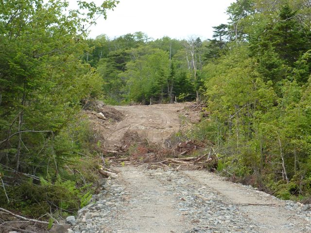
Soon we detour off the Trail and make for the tiny village of Meatcove at the top of the Island, coming to Capstick along the way.


From Capstick, the way turns to gravel for three miles as it steeply climbs to the top of the cliffs at Meatcove.
Traversing this road by bike is not for the faint of heart.


But you are rewarded with the most spectacular scenery !


Can I have your bike when you fall, John ?

That way to Europe !
We continue a little farther before the road dead ends at this sign in the middle of nowhere.


A Goldwing is no off-roader, lemme tell you, as we carefully make our way back to the main road.
More coastal scenery at Green Cove, a rocky outcrop that juts out into the sea, as we travel south down the eastern side of the Island.

We missed a turn somewhere as we ended up taking the Englishtown ferry, all of five minutes across St. Anne's Bay.
Wouldn't a bridge be better?


Gas stations are far and few in between and we are running on fumes searching for fuel as we cross Seal Island Bridge that spans the channel connecting Bras d'Or Lake with the Atlantic Ocean.

With only a few miles to spare, that was too close!
First time I got 260 miles on a tank. First time I could see the bottom of the tank, too


Returning to Baddeck we meet some more friendly Newfoundlanders on their way to see the upcoming U2 concert in Moncton, New Brunswick, the last stop of the band's current tour which had much of the Maritimes buzzing.

Nearby we stop for the night at the Cabot Trail Motel, where I absent-mindedly left behind my favourite riding gloves.


I like this place already !


Dinner in town at the Yello Cello Café.
Day 6- Thurs, July 28
Our sixth day will have me do 435 miles in 13 hours, from Baddeck to Lunenburg, then back to Indian Harbour.
View Larger Map

After filling up first thing this morning, John quickly jumps on his bike, turns to me with a haggard look on his face and says suddenly, "I'm going home." I was incredulous!
He goes on to say how worn out he has become, especially after his long trip to California earlier this year. Certainly I could tell the last two days of dreary weather were wearing on him, but I never thought I'd hear him say he's done in by riding. John reluctantly admitted as much, too.
So we wished each other well for a safe return home.
Then I watched him ride away.
 Back on the Nova Scotia mainland, I stop in Sherbrooke for a bite to eat.

 Luv the beer !

Travelling westward along the south shore, a slow moving logger is a pain with all the crap flying off, but the smell of fresh cut pine is intoxicating!


Travelling westward along the south shore, a slow moving logger is a pain with all the crap flying off, but the smell of fresh cut pine is intoxicating!

Near Halifax, hockey fans will know this place.


The Angus L. MacDonald Bridge spans Halifax harbour from Dartmouth, where I took this pic from, to Halifax, capital of Nova Scotia.

The Citadel, a national historic site, overlooks the city of Halifax.
Built by the British in 1856, it was the fourth in a series of forts since the mid-eighteenth century atop the hill that commands the harbour guarding against foreign incursion.

Views from Citadel Hill.


Less than an hour from Halifax is the famous fishing village of Peggy's Cove.


Despite being one of Canada's top tourist destinatians, Peggy's Cove maintains its rustic setting.


Peggy Cove's iconic lighthouse.


Recently though, a theory put forward by RCMP crime scene investigator Tom Juby speculates that the fire may have been deliberately set due to the number of gov't officals and diplomats, valuable jewelery, paintings and paper currency on board. The flight was used regularly for travel between the United Nations headquarters and Europe.
Juby was stymied by federal officials from conducting a criminal investigation into the crash.
I visited the Whalesback memorial site, one of two marking the communities, the other in Bayswater, that assisted in the search efforts mostly with their own fishing boats.


Certainly not over the top unlike, in my opinion, the Flight 93 memorial in Shanksville, Pennsylvania.


The Fishermen's Memorial and Tribute honours those mariners from Lunenburg County who lost their lives at sea from 1890 to the present.

Dusk was fast approaching so I couldn't spend as much time in Lunenburg as I wished.
Time to get back to the motel in Indian Harbour.
Day 7 - Fri, July 29
A gruelling 14.5 hours today and 456 miles.
I had originally planned a full day travelling around the western tip of Nova Scotia to catch the ferry at Digby the next morning. But I was anxious to steal a day's ride for home, so after four hours of sleep I awoke at a chilly 230am and set off through the night to make the first crossing, stopping for coffee . . .


. . . along the way in Tantallon and Coldbrook to fortify myself.

I arrive at the ferry terminal in the predawn of 530am. Good thing, too, because there were few open spaces left as most were already reserved.


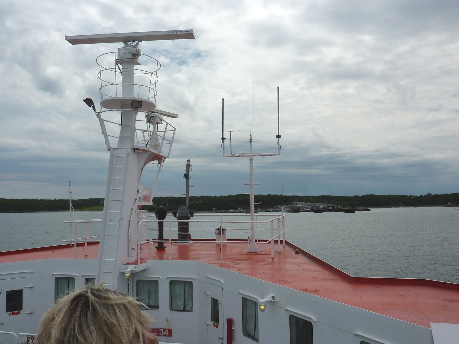
The Princess of Acadia is a big ship with a capacity of 180 vehicles and 650 passengers, making the 3-hour passage across the Bay of Fundy from Digby northward to Saint John, New Brunswick.

We set sail at 800am.


Fog shrouds much of the journey as I chat with George, a French-Canadian chap also travelling by bike on his way home to Montréal.


Once on the highway after Saint John, I begin making my way westward for home.
I stop at the Bay Breeze Motel and Restaurant in Pocolagen, praised as one of the best roadside eats in the country, overlooking the fog-shrouded Bay of Fundy.


Damn good freshly caught halibut !


After a long day I check in at 530p at the Mountain View Campground in Dixfield, just in time as it begins to rain for the night, but I stay dry in the tent.
Fortunately, it is the only rain I encountered during the entire trip.
Day 8 - Sat, July 30
My final day would take me a butt-numbing 710 miles in 19 hours.
My final day would take me a butt-numbing 710 miles in 19 hours.
View Larger Map
"Eight Days on the road and I'm gonna make it home tonite!"

Awakening to a clearing morning sky, I set out by 700am.

Stopping for an egg mcMuffin and coffee in Rumford.
A gorgeous morning, indeed !

Approaching the White Mountains of New Hampshire.

Some great twisties to be found in Camel's Hump State Park in Vermont.

Okay, so it's not Tim Hortons, but I needed a coffee !
This was in St. Johnsbury, Vermont.

Waiting to board the ferry at Chimney Point for a short hop across Lake Champlain to Crowne Point in New York State.


The bridge will soon replace the ferry.
Take note, Englishtown.

Approaching Crowne Point.


Heading northward along the western side of beautiful Lake Champlain.


Stopping for lunch in Westport.

The Adirondack Mountains

I ascend Whiteface Mtn. to the castle summit.

At the summit at an elevation of 4600 feet above sea level, accessed by Whiteface Mountain Veterans Memorial Highway.


A memorial plaque dedicated to America's fallen soldiers.
The view from above.

Lake Placid

Saranac Lake

Nearby is the town of Lake Placid, site of the '32 and '80 Winter Games.

The Olympic hockey arena where the Miracle On Ice took place when Team USA stunned the hockey world by defeating the powerful Soviet Union to advance to the finals.


Strrolling around this very pretty but tourist-filled town.
Then it's on to the Thousand Islands border crossing at the eastern end of Lake Ontario at dusk to re-enter the land of the Maple Leaf.
;)


But not before a stop at the Duty Free for some hootch !


Crossing the St. Lawrence River back into Ontario.

A final stop in Ganonoque to fuel up on more of Timmies' finest before the final three hour push for home.

Parked safely home in my garage once more by 200am Sunday morn, tired but joyously overwhelmed at the enormity of the trip I had just completed.
In eight days I covered 3600 miles (5758 km) at an average of 450 miles per day.
In eight days I covered 3600 miles (5758 km) at an average of 450 miles per day.

All in all, a fabulous trip on a fabulous motorcycle.
My Goldwing as always was up to the task, performing flawlessly as it was designed with speed, comfort, and performance.
But despite all the months of anticipation of making this Cape Breton adventure, am I the only one who felt the Cabot Trail did not live up to the grandeur for which it is highly touted?
Some spectacular landscape indeed, but I found there wasn't all that much of it. Most of the scenery was on the west side of Cape Breton Island. Once we rounded the top and came down the east side, the road became mostly forest and bush.
What I really loved was the Gaspé Peninsula. John had been there a few years earlier and urged me to include it in the trip.
The scenery was incredible with the St. Lawrence River as your backdrop, the towns and villages more isolated and desolate the farther one travelled. Rte. 132 that circled the peninsula was an absolute joy to ride. And the friendliness of the Acadians, these distinctly special people within Quebec, and their bonhomie were always in abundance.
The Cabot Trail was my reason for going, but the the Gaspé will be why I hope to return someday !
